
Getting around in Phoenix generally means driving. Newcomers from New York, Boston, Chicago, or San Francisco will definitely note the more modest public transport options. Valley Metro has extended the light rail into a two-line network, and Tempe has a streetcar, but public transport is thin outside those corridors, and basically everyone drives.
Valley Metro is expanding its service, and it’s carrying more passengers each year, but progress has been patchy. Valley Metro opened the South Central line to Baseline Road well ahead of schedule, but the Phoenix City Council has since dropped the planned Capitol extension in favour of a future line into West Phoenix. For now, you need a car to get the run of the Valley.
Air quality is another sore point. Regulators classify the Valley as failing federal ozone standards, and traffic is a major contributor to the poor air quality.
Public transport in Phoenix
Public transport in Phoenix is run by Valley Metro, the regional authority behind the buses, light rail, the Tempe streetcar, and paratransit. You can plan a journey and check for disruptions on its website or in its app. Paper passes are gone, and under the Smart Fare system, you pay through the app or with a reloadable Copper card, and Valley Metro caps your fares automatically once your daily, weekly, or monthly total hits the ceiling.
Light rail
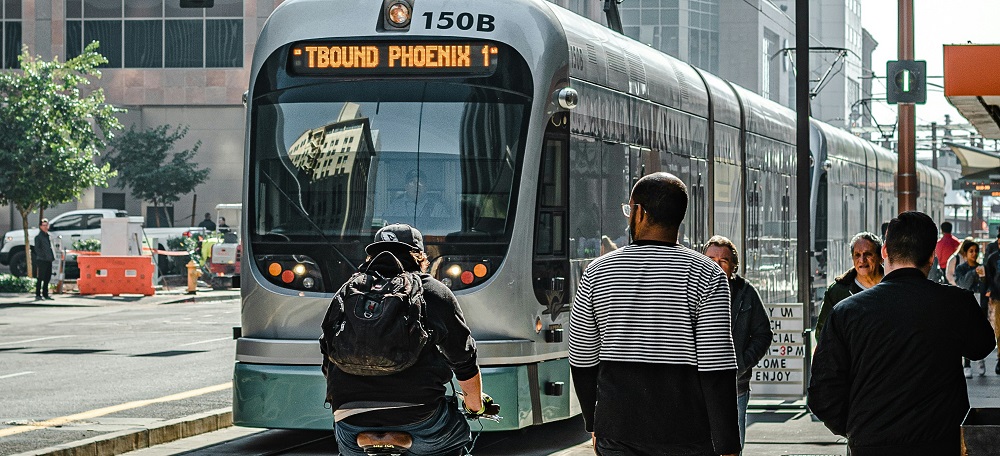
The light rail is the cheapest and most dependable way of crossing central Phoenix, and it has two lines that meet at the Downtown Phoenix Hub. The A line is the east-west route between Gilbert Road in Mesa and downtown; the B line is the north-south route between Metro Parkway in northwest Phoenix and Baseline Road in south Phoenix. The network is 35 miles (56km) of track and has close to 50 stations. Riders can take the trains to Sky Harbor airport, the ASU campus in Tempe, the downtown sports venues, and the bars on Mill Avenue.
Trains run every 12 minutes at peak times and every 15 to 20 minutes the rest of the day. The first trains are out before 5am, and the last ones finish around midnight from Monday to Thursday. Friday and Saturday’s trains run until about 2am, and on Sunday, the last train is at 11pm.
Streetcar
The Tempe streetcar, known as the S line, runs along a three-mile (5km) route. from Marina Heights and Tempe Town Lake, down Mill Avenue past the ASU campus to Apache Boulevard, where it meets the A line. Streetcars come every 15 to 20 minutes, and the fare is lower than a standard Valley Metro ride.
Buses
The bus network in Phoenix is far bigger than the light rail, but there are a few issues with it. Regulars complain that buses turn up late or not at all, especially in West Valley. Bus stops with no shade are a summer misery.
Most buses start at 5am and are off the road by around midnight. The busy arterial routes run longer and more often than the suburban feeders, so check the timetable in the app before you set out.
Useful links
Taxis in Phoenix
Taxis in Phoenix are a shrinking trade, and most people now reach for a ride-hailing app instead of a metered cab. Nevertheless, you will find cabs waiting downtown near the big attractions and the light rail stations. Out in the suburbs, call ahead and book. Fares are metered and fair enough for a short hop, but distances here are punishing, and you will feel it if you take cabs every day.
Uber and Lyft are the default for most people, and both are cheaper and easier than a conventional cab. Phoenix is also Waymo country. Waymo has been carrying paying passengers here since 2020, and its driverless cars are now available across much of Phoenix, Scottsdale, Tempe, Chandler, and Mesa.
Useful links
Driving in Phoenix
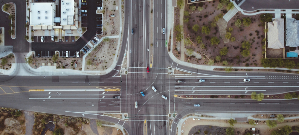
Driving in Phoenix is how nearly everyone gets around, and the Valley was laid out with that in mind. Arterial roads are set on a one-mile grid, and parking is plentiful. The freeway network is extensive: I-10 and I-17 are the through routes, and the Loop 101, Loop 202, and Loop 303 are ring roads around the suburbs.
New arrivals will find their bearings quickly because the street plan is simple. There are numbered avenues west of Central Avenue, and numbered streets east of it. Nearly every road name includes a compass direction to pin the address down. Cities beyond the Phoenix limits, like Tempe and Avondale, have their own grids.
The freeways in Phoenix are permanently under construction, and it’s quite routine for there to be closures on weekends. Peak-hour congestion on I-10 and I-17 is the worst of it, and commutes from the far suburbs, such as Buckeye and Queen Creek, can be brutal. Check AZ511 before you set off.
Arizona has some of the strictest drink-driving laws in the country. For a first conviction, the courts impose a mandatory jail term, heavy fines and fees, a licence suspension, and an ignition interlock device on your car. Police checkpoints are common, and the courts will show little mercy. If you are out for the night, you can organise a designated driver, book a ride or a taxi, take a Waymo, or plan your way home on the light rail, which runs until about 2am on Friday and Saturday.
Driver’s licences
You need an Arizona driver’s licence as soon as you take a job in the state, and the Motor Vehicle Division (MVD) handles it. Arizona has reciprocity deals with four countries. Licence holders from Germany, South Korea, and Taiwan skip both the written and the road test. Canadians skip the road test but sit the written exam. Everyone else takes both, plus a vision screening.
Book through the AZ MVD Now portal, and ask for the Arizona Travel ID while you are there, because airport security will not accept a standard Arizona licence for a domestic flight.
Useful links
- Arizona Department of Transportation: Motor Vehicle Division
- Arizona MVD: Driver Licences for Foreign Applicants
- AZ511: Real-Time Road Conditions
Cycling in Phoenix

Cycling in Phoenix is easier than the city’s reputation suggests, at least for eight months of the year. The terrain is flat, and the winter weather is made for it. The city has laid protected bike lanes downtown, off-street paths along the canals, bridges over the busiest arterials, and bike racks on the front of every bus. It is also planting trees along designated cool corridors to shade the routes people walk and cycle most. From May to September, the heat makes midday riding dangerous, and regular riders go out at dawn.
HOPR runs Grid Bikes, the official bike-share scheme in Phoenix and neighbouring cities such as Tempe and Mesa. Unlock a bike through the app, then lock it to any public bike rack at the end of the ride. There are cheaper monthly and annual passes for regular riders. Leisure riders have the canal towpaths, the Rio Salado Pathway, the desert trails around South Mountain Park, and the long climbs out towards Cave Creek.
Weather and Climate Chart for Phoenix
Useful links
Walking in Phoenix
Walking in Phoenix is a pleasure for eight months of the year and a trial for the other four. The metro area is far too spread out to walk to work unless you live in the central corridor, but the older neighbourhoods are worth exploring on foot. Garfield, Eastlake Park, Booker T. Washington, and the galleries along Roosevelt Row are all walkable, and downtown is compact enough to cross in twenty minutes.
Summer is another matter. Daytime highs are above 100°F (38°C) for months at a stretch, and the pavements are still hot after dark. The city has established an Office of Heat Response and Mitigation, the first of its kind in the country, and is planting trees and installing shade structures over pavements and bus stops. Locals do their walking at dawn, and they carry water even for short trips.